Media Gallery

Project Details
- Type
- Mixed Use, Affordable Housing, Environmental Sustainability, Residential, Housing, Waterfront, and Commercial
- Ward
- Toronto-Danforth
- Councillor
- Paula Fletcher
- Current Phase
- Pre-development
- Current Use
- Various/vacant
- Major Intersection
- Lakeshore Boulevard East and Saulter Street
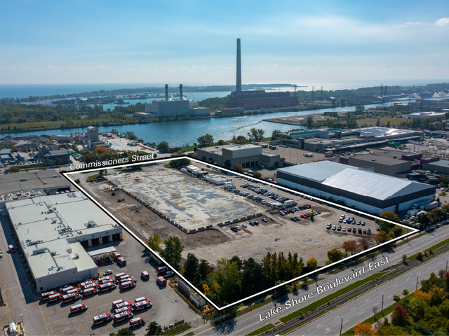
- Site Area
- 21.5 acres
- Proposed Use
- Mixed-use housing and commercial
- Surrounding Use
- Industrial Uses
- Type
- Mixed Use, Affordable Housing, Environmental Sustainability, Residential, Housing, Waterfront, and Commercial
- Ward
- Toronto-Danforth
- Councillor
- Paula Fletcher
- Current Phase
- Pre-development
- Current Use
- Various/vacant
- Major Intersection
- Lakeshore Boulevard East and Saulter Street
- Site Area
- 21.5 acres
- Proposed Use
- Mixed-use housing and commercial
- Surrounding Use
- Industrial Uses
Project Overview
Join us for an open house to celebrate progress in the Port Lands and learn what's to come!
Port Lands Open House: From Plan to Place
6 to 8:30 p.m. on Tuesday, March 10
Ralph Thornton Community Centre (765 Queen St. E)
Register here: Eventbrite
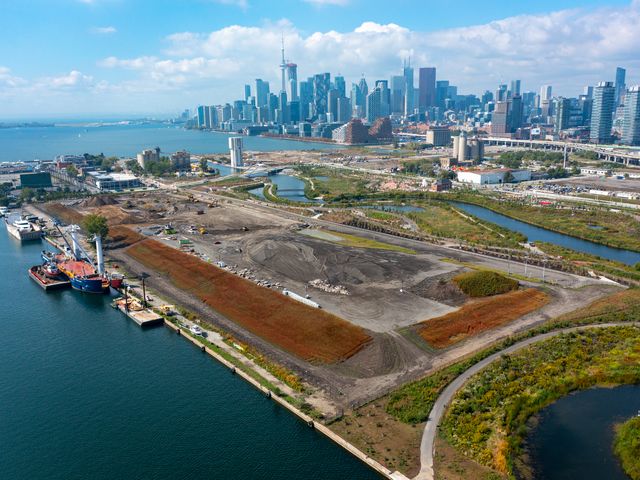
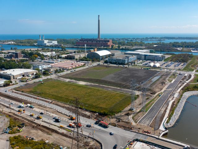
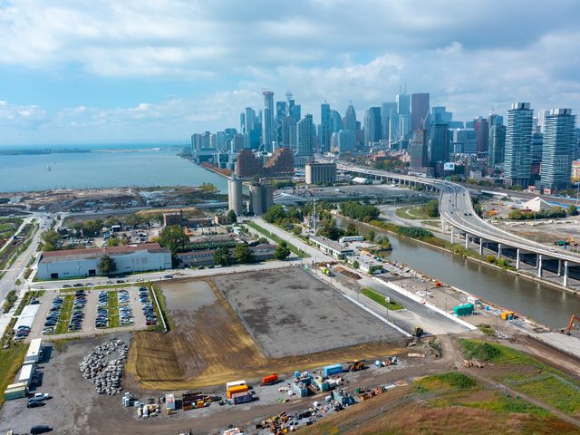
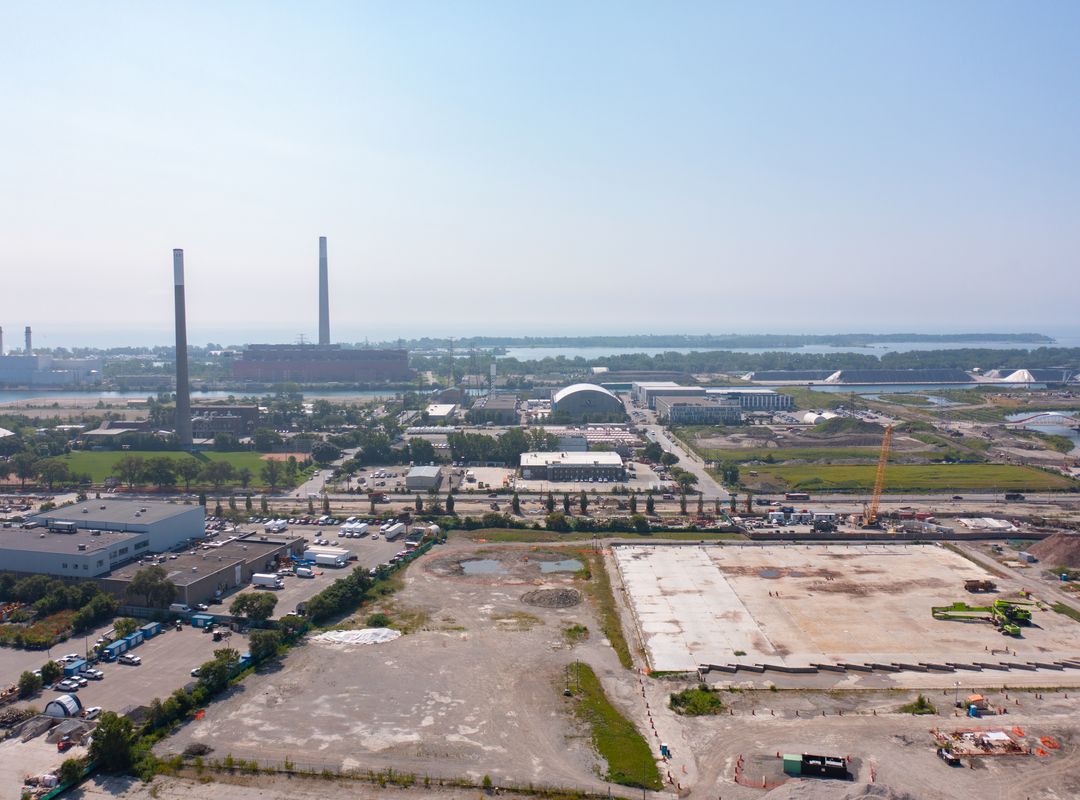
Comprised of close to 50 acres of land, McCleary District will be another mixed-use community that will forever change the makeup of the Port Lands. Bounded by the Don Roadway to the west, Commissioners Street to the south, Lake Shore Boulevard East to the north and Logan Avenue to the east, McCleary district is envisioned as a dense, transit-oriented, complete mixed-use community and hub of activity. The district will have a mid-rise feel, contribute to broader economic objectives and complement the office destination envisioned to the north. The land-use mix will create a healthy balance and enable key economic clusters synergistic with districts to the south.
Of these 50 acres, 21.5 acres are City of Toronto and CreateTO lands. CreateTO is currently leading the precinct planning process in collaboration with the City and Waterfront Toronto. The McCleary District Precinct Plan will provide more detailed direction for the District, building on the Port Lands Planning Framework and Central Waterfront Secondary Plan (CWSP).
McCleary District will be a lively neighborhood combining new homes with creative industries and extensive public spaces, celebrating its industrial history while also supporting Toronto's growing creative economy. The proximity to the East Harbour Transit Hub and the new waterfront transit and active transportation network will support a dense, walkable and transit-oriented community.
Project Materials
Resources
- October 2024 - McCleary District Precinct Plan Study Update(Opens in a new window)
- July 16, 2024 - Presentation to the Port Lands Stakeholder Advisory Committee (SAC)(Opens in a new window)
- July 12, 2024 - Presentation to the Port Lands Landowner and Users Advisory Committee (LUAC)(Opens in a new window)
Community Engagement
- March 2025 – McCleary District Indigenous Engagement Circle #2: Meeting Summary(Opens in a new window)
- December 2024 - McCleary District Indigenous Engagement Circle #1: Meeting Summary(Opens in a new window)
- September 18, 2024 - McCleary District Public Information Session Boards(Opens in a new window)
- September 18, 2024 - McCleary District Public Information Session Presentation(Opens in a new window)
Project News
 September 9, 2024Design, consultation work by Toronto agencies continues on massive Port Lands housing developments(Opens in a new window)September 9, 2024While many of the houses and apartments in Toronto’s South Riverdale have been around for decades, planning is underway in the Port Lands for two massive new communities where homes haven’t existed before.
Port Lands