Media Gallery


Project Details
- Type
- Mixed Use, Affordable Housing, Environmental Sustainability, Housing, Residential, Commercial, Waterfront, Retail, Office, Commercial, and Community Space
- Ward
- Toronto-Danforth
- Councillor
- Paula Fletcher
- Current Phase
- Pre-development
- Current Use
- Various/vacant
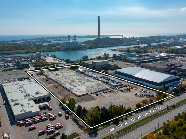
- Site Area
- 54 acres
- Proposed Use
- Mixed-use housing and commercial
- Surrounding Use
- Industrial Uses
- Type
- Mixed Use, Affordable Housing, Environmental Sustainability, Housing, Residential, Commercial, Waterfront, Retail, Office, Commercial, and Community Space
- Ward
- Toronto-Danforth
- Councillor
- Paula Fletcher
- Current Phase
- Pre-development
- Current Use
- Various/vacant
- Site Area
- 54 acres
- Proposed Use
- Mixed-use housing and commercial
- Surrounding Use
- Industrial Uses
Project Overview
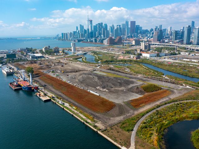
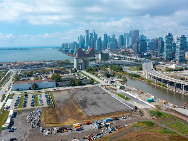
As the first mixed-use development project in the Port Lands, Ookwemin Minising will help mark the long-term transformation of the area that has always been known for its industrial uses. The future live, work, play Port Lands neighbourhoods will be interwoven with the industrial landscape. Ookwemin Minising will be surrounded by vast green spaces and parks, public spaces and ecological richness that will result from the naturalization of the Don River. This creates an opportunity to build more housing, including affordable housing. Ookwemin Minising is planned to include a minimum 20 per cent and target of 30 per cent affordable housing on public lands.
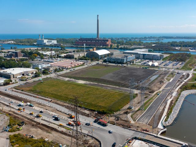
Ookwemin Minising shaping is currently underway through a series of big infrastructure and transformational moves, the most substantial of which is naturalizing the mouth of the Don River as part of the Port Lands Flood Protection work and restoring the historic Keating Channel. When the new mouth of the Don River is built, the new urban island will emerge.
Ookwemin Minising will be a main gateway into the Port Lands from new urban areas to the north. Bordered by four distinct waterside edges and open spaces, Ookwemin Minising will become a special island community and will create a more accessible Toronto waterfront for all.
Density Study
In 2022, Toronto City Council directed the City of Toronto, Waterfront Toronto and CreateTO to revisit the precinct plan that was approved in 2017 with the goal of increasing the number of homes that can be built on the island while respecting the overall vision for the project.
A Density Study was then conducted to determine the appropriate amount of new density for the Island. A public meeting was held in June 2023 to share different approaches to increasing density on the island and feedback from the meeting, as well as from past consultations, informed the proposed updates to the plan. In March 2024, a virtual public meeting was held to report back on the results of the Density Study and to present future opportunities for public input.
In November 2024, The City of Toronto announced the name of the island after a year-long engagement and consultation process where the City turned over naming power to the Indigenous community as part of its commitment to reconciliation. The park was formerly known as "Villiers Island."
Project Materials
Community Engagement
Resources
- Press Release - New island in the Port Lands named Ookwemin Minising, place of black cherry trees(Opens in a new window)
- 2024 - City-Initiated Official Plan and Zoning By-law Amendment(Opens in a new window)
- 2024 - New Island, New Beginnings: Further Reconciliation and an Indigenous Cultural Framework for the Port Lands(Opens in a new window)
Project News
 October 3, 2023Toronto gets a new island, and the responsibility to get it right(Opens in a new window)October 3, 2023It is a sunny day in September, 2033. You are standing on Toronto’s Villiers Island – created when the mouth of the Don River was naturalized almost a decade ago – and wondering what to do with your day.
 *Villiers Island has been renamed to Ookwemin Minising. CreateTO, together with the City of Toronto and Waterfront Toronto, will be hosting a public meeting on Monday, June 19th to discuss the future development of Villiers Island and how best to increase density in this new waterfront community.
Port Lands